Tide app feature
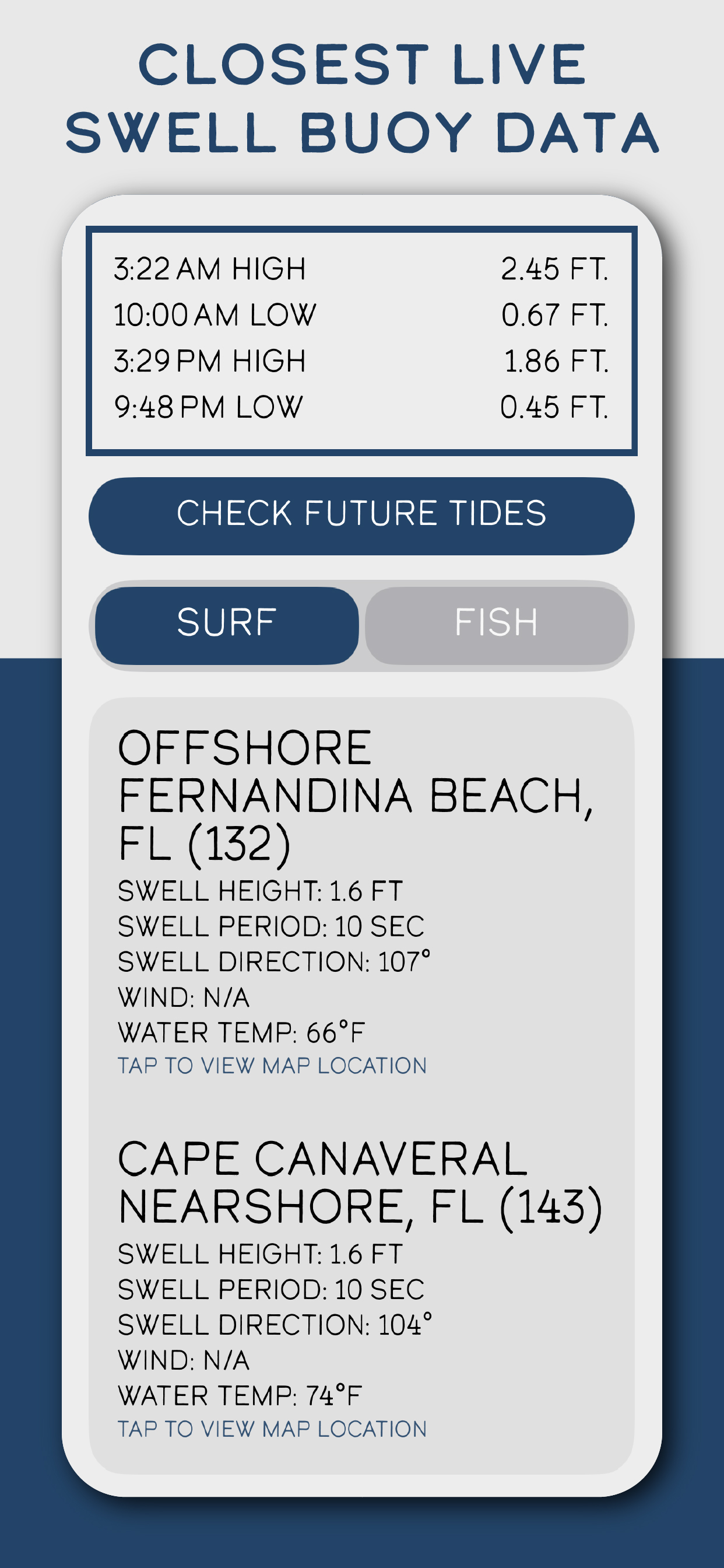
Closest Live Swell Buoy Data
Tide Buoy is not only about tide times. For many ocean users, swell context matters too. This view brings nearby buoy details into the same planning flow so the app feels more useful for real coastal decisions.
Why this feature matters
Tide alone does not explain the full picture for surf and ocean exposure.
Nearby buoy data helps you understand what the ocean is sending toward your coastline.
Having swell height, period, direction, and water temperature close at hand keeps planning simpler.
How Tide Buoy uses it
- Surfaces the closest live buoy readings in an easy-to-scan card layout.
- Pairs those readings with tide context so you can read both together.
- Keeps the view simple enough for quick checks before you head out.
Best real-world uses
- Checking if the swell is worth a surf session.
- Comparing ocean conditions between favorite spots.
- Using water temperature and direction data to prepare better before arrival.
Want to try this in the app?
Tide Buoy brings this feature into a simple, mobile-first tide app experience built for the coast.
Related features
FAQ
Closest Live Swell Buoy Data questions, answered
Clear answers help both humans and search engines understand what this Tide Buoy feature actually does.
Is buoy data useful without surf knowledge?+
Yes. Even casual coast users can use swell height, period, and direction to understand how active the ocean is.
Why combine tide and swell information?+
Tide and swell together give a fuller picture of the water than either one alone.